Contents
Index
Read Google Elevations
This option will read height values from the Google Elevation service for the selected points.
This function connects to the Google web pgae via the Internet.
Google imposes usage restrictions on this service.
See http://developers.google.com/maps/documentation/elevation/#PointElevation
for more details.
The Google Elevation service maintains a database of height values for the entire surface of the earth.
You can look up a height value by submitting a location as a latitude/Longitude value and it will return the
Elevation at that point.
In most cases, it will need to interpolate the height value from surrounding points.
It also returns a 'Resolution' which is the distance in metres to the nearest point.
The resolution value is shown in the 'Remark' field for a point.
The Elevation service only works in geographics (latitude and longitude) so you must have a datum.
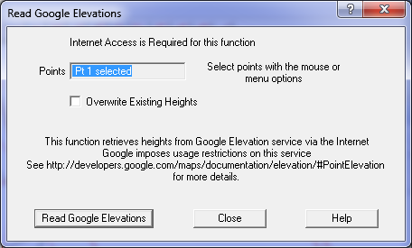
Overwrite Existing Heights
Tick this box to replace existing height values with the values from Google Elevation Service.
This option will query up to 10 points in one request, so you should be aware of how many 'requests' you send to Google each day
to avoid being barred from the service.
See the web site for more details.